Back to Weendoggy.com
 We're off again for another "Road Trip",
in our topless Factory Five Roadster (Cobra).-
or -
How to drive (litteraly) your wife crazy!
Utah
May 6-12, 2013
Latest update, May 13, 2013Aptos, CA
Off on another adventure? You bet! What else could happen? Tornado? Hurricane? Flood? Well, I guess it could, but we're hoping for better weather than we had on our trip in 2009. At this point, I'm not sure if I'm going to tow the Cobra there and take the trip, or drive it all the way. I'll make that decision at the last minute, so you'll have to follow along to see what choice I made. We're leaving May 6th and arriving to meet up with the Utah Cobra Club for a four day excursion through Southern Utah.
Did I forget to mention this is only a seven (7) day trip. Thought it best to limit our time on the "open road" so to speak in case we do hit inclement weather, which could easily put a damper on things. No pun intended. 
I contacted the Utah Cobra Club last year in hopes of making their trip to Idaho, but work got in the way. So, this year, knowing I was going to be retired (from my full time job), I made plans to join them on their trip and see some country we've never seen. The plan is to meet at Larry Johnson's house (who I've met during a Factory Five outing in Las Vegas years ago and Willow Springs Raceway), and travel to Fillmore, Cove Fort, Richfield, Big Rock Candy Mountain, Bryce Canyon, Escalante, Torrey, Hanksville, Goblin Valley State Park and Green River. Looks like it's going to be a good outing. Total mileage of the trip to be about 660 miles not including our drive there and back.
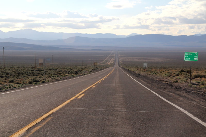
The route to Utah will be along Highway 50 across Nevada. "The Loneliest Road in America", also part of the Lincoln Highway. If we don't drive that way there, we'll be coming back this way. Either way, I'm doing Highway 50.
--- Overview of Highway 50 through Nevada ---
Welcome to Highway 50, the Loneliest Road in America. This highway crosses Central Nevada through the
Great Basin, a unique area because no water leaves the basin. Rivers begin, run, and go underground. They
may resurface once in awhile but soon return underground.
The route Highway 50 follows has been a pathway for travel for centuries. The Native Americans followed
migrating herds of deer, antelope, and other game across Central Nevada. Early explorers crossing Nevada
included John Fremont and Jedediah Smith. The Overland Stage later followed Smith’s route; then the Pony
Express took this route, and finally, the transcontinental telegraph came over this area. On July 1, 1913, the
Lincoln Highway Association was organized at Detroit, Michigan with the objective: “To procure the establishment
of a continuous improved highway from the Atlantic to the Pacific, open to lawful traffic of all descriptions
without toll charges and to be a lasting memorial to Abraham Lincoln.” (Lincoln Highway Association
brochure) The Lincoln Highway was the first coast-to-coast highway, running from New York City to San
Francisco. Dwight Eisenhower backed the idea as a young lieutenant colonel in the Army trying to move
troops across the country. When he became President of the United States, he promoted the Interstate highway
system.
Today, highways take travelers across the country in comfort. Reading journal accounts of pioneers crossing
Nevada to get to the west coast, one can really appreciate travel conditions today.
The mountain ranges of Nevada run north to south with valleys between. This is known as Basin and
Range formation in the High Desert. This makes Central and Eastern Nevada a one-of-a-kind place. As you
travel, take time to enjoy the open spaces, abundant wildlife, unique plants, and friendly communities. A narrated
CD of the area has been developed and can be found in the local chamber of commerce or tourism offices.
The towns along Highway 50 each offer points of interest, museums, historical buildings and sites, special
events, a variety of services and interesting shops. Visitors can rest assured that all the
necessities can be found along the route. However, it is a long way between places. The wise
traveler knows it is best to carry extra water and warm clothing because this is mostly high
desert; conditions and temperatures can change quickly. Travel with your gas tank filled. Watch
for wild life including deer, elk, coyote, rabbits, birds, cows, horses, and other critters. This is
open range country so any of these may be on the road ways, especially at night. Enjoy your
trip through Nevada and plan enough time to enjoy all the attractions along the way.
Nevada Highway Speed Limits Map
---------------------------------------
Here's a link to current road conditions in Nevada and Utah (click on Statewide Map and Hide Cameras to view entire state).
UPDATE!!
Looks like the weather is going to be a blessing and as of now (5/1/2013), so we're going to be driving all the way!! Made our reservations for a stop in Fallon, NV and plan on stopping in Austin, NV for a fuel stop (both Cobra and us) at the Toiyabe Cafe on Tuesday morning before heading on to the Provo, UT area. We'll meet the group at Larry's the following morning. During the trip, the last day will be a return trip through Sin City (Lost Wages) i.e. Las Vegas, NV along I70. Then it'll be a trip home to Aptos, CA from there. That's if all goes to plan.
I'm allowing two full days to get to Utah with a stop in Nevada and we'll be checking email so if you'd like to drop a line, do so here: weendoggy@aol.com or, you can email Jeanne at: jt81cruz@aol.com However, this route can change at the last minute.
One thing for sure this time is to drill several "drain" holes in the footbox to allow water to drain OUT and not create a mini-lake like last time. I'll have plugs installed and when/if needed, pull the plugs to allow the water to exit the cockpit. Yeah, gotta' be prepared, unlike the last trip. I'll also need to make sure I have the car cover ready to put over us in case of a downpour in areas that don't have an overpass for protection. Driving Hwy. 50 we'll surely need this to keep us dry. We make look funny on the side of the road, but we'll be dry! Now, where did I put my friend Reno's "weather window"?
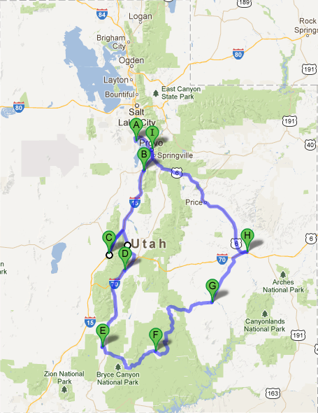
Map of proposed Utah Club trip.
---- The Trip ----
I've added hyperlinks for major spots so you can see or read about the area we're visiting or driving through. I'll be posting some pictures I take along the way as well so you can see what we see! If you have questions, you can email us at the links above.
Thanks again for following along.
Oh, did I forget to say a "snow adventure" earlier?
Day 1
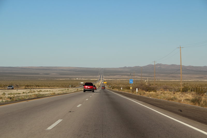
Leaving Aptos around 5 or 6am on Monday the 6th and driving over Hwy. 88 through the Sierra's and then catching Hwy. 395 to Hwy. 50 and on to Fallon, NV. for our first day, which should take about 7 hours total time. I think this will break up the two day drive into equal shares so we/I don't wear ourselves out.
OMG! How soon weather changes!
We left on time and headed for Fallon, NV. Made a stop in Tracy for gas and food and then off we went to Hwy.88. Oh, did I forget to say the sign said "Snow Chains Required at Kirkwood"! Holy snowball Batman, we have a problem!
I decided to see how long controls were in effect and we had just stopped to clean the windshield when a driver coming the other way pulled over and said, "kinda' cold for a drive today", to which I said, "yep, but doable". I asked if the controls were lifted and he said all was good. A little foggy and light rain/snow in spots but o.k. He also told me he owned a Superformance. Thanked him for the information and off we went. He wasn't kidding either.
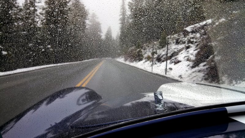
Just before Kirkwood Ski Area
Yeah, that was some driving through there, this even got better as we drove along just past Caples Lake.
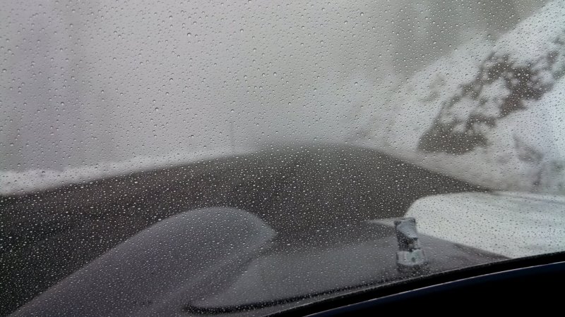
Just before the Carson Pass Summit.
After getting over the pass we drove into Carson City and were welcomed by a deluge of rain! I mean the kind that makes you say, "what the hell was I thinking rain". We scooted into a gas station and gas'd up and waited for 20min. for it to subside a little. Then we were off again to Fallon. The weather was a little better but we did get some more sprinkles along the way. Once in Fallon, we found our hotel, got a bite to eat, cleaned the car and called it quits until tomorrow. Watching the news is only telling us to be prepared for more of the same for the next three days. Oh boy! We can't wait!
More surprises just waiting for us.
We'll see what happens tomorrow morning. Our plan is to get around 4:30am to beat some of the possible thundershowers they're talking about. Hopefully we can be at our destination in Orem/Provo, UT without looking like drowned rats!
Day 2
Continue on to Provo, UT through Austin (breakfast and fuel stop) and Ely, NV; Delta and Nephi, UT. Plan is to get in around 3pm and get rested, clean the car and get ready for the rest of the trip. This will probably be a 8-9 hour day.
Got up early (3:30am) and got ourselves ready to go. A light sprinkle was coming down, but nothing major, yet! Off we go in the dark at 4:15am to Austin for breakfast. Highway 50 is a lonely road to be on in the dark. Nothing is moving, even traffic. We saw two pickup trucks pass us just after leaving Fallon, and then it was nothing until we got about 10 miles from Austin.
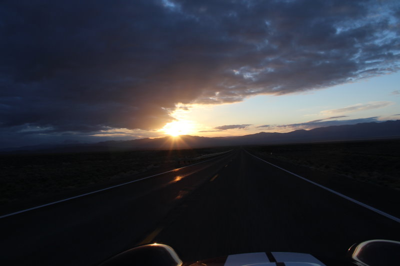
Sunrise on Highway 50, somewhere!
We pulled into Austin a little past 6am. Got gas at the Chevron (they wanted our car), and then found the Toiyabe Cafe and had breakfast. The drive went fairly well until 5:30am when we got drowned by a deluge going over one of the pass's to Austin. Lucky for us it only last about 5 minutes, but it was COLD! The people at the Chevron told me it was 38 degrees this morning. I bet it was!
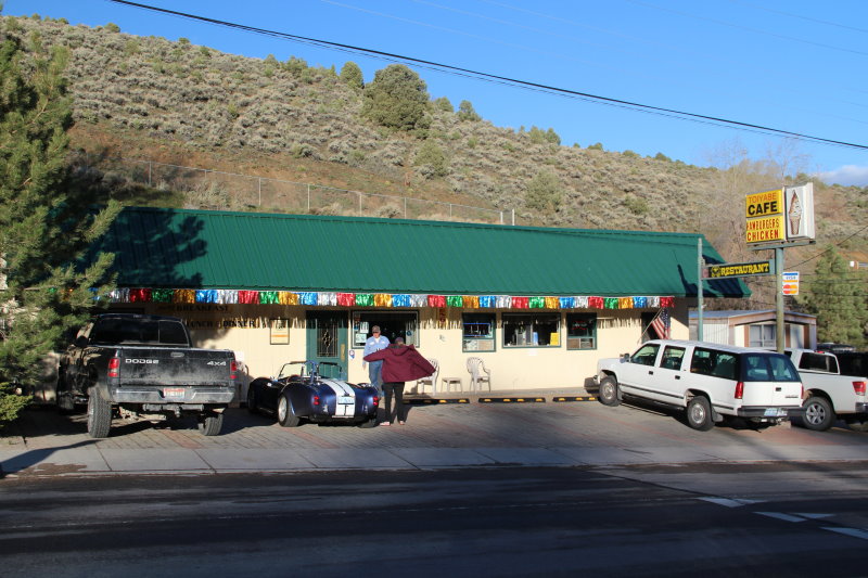
Toiyabe Cafe in Austin, NV
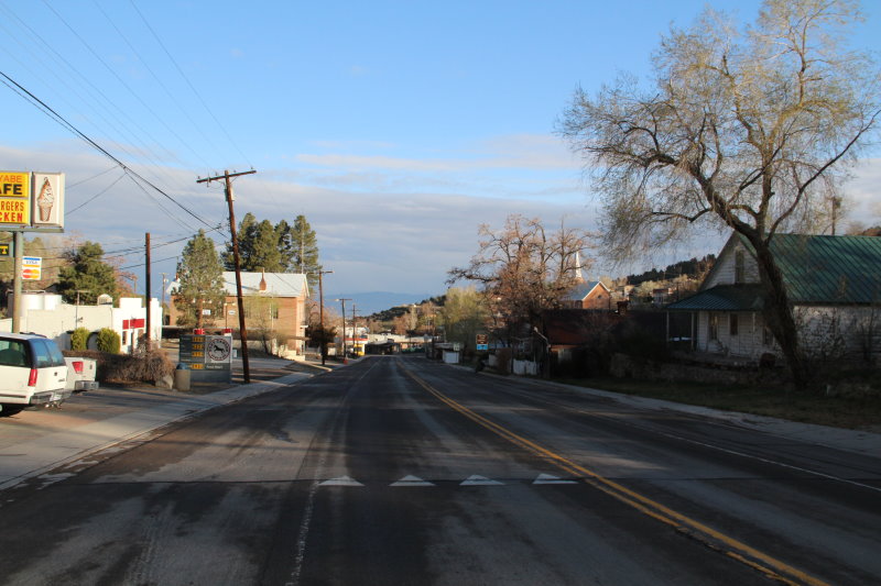
Austin, NV looking west.
Before we got in the car, I had Jeanne put on my extra windbreaker under her jacket and I had on my fleece vest, pullover and jacket before heading out. We wanted to make sure we were ready for cool weather. Good thing we did because after leaving Austin we immediately started climbing to the first of nine, yes 9, pass's that average 7300 ft. on our way to Ely. Weather was very good. A little cool, but the sun was keeping us warm (a little).
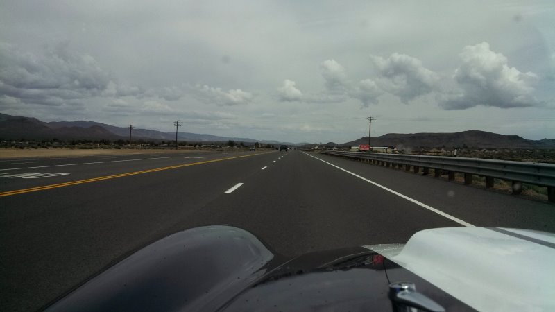
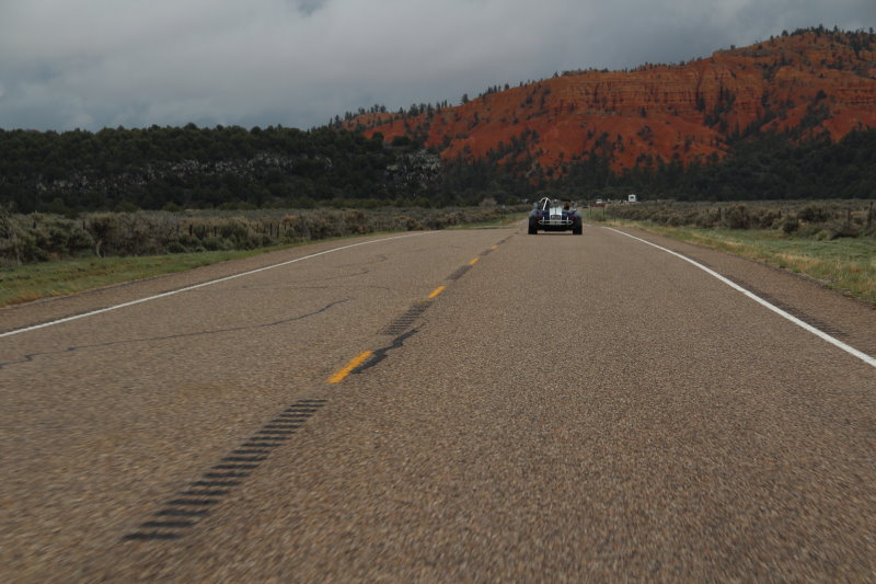
Open road ahead, Hwy. 50, NV.
Jeanne was bundled up as well as could be and all I saw was glasses. I also noted my rear view mirror was filled with snow capped peaks. That's how cold it was going over all those passes. Another blessing was no chains required on any of them! We did get some light sprinkles here and there but overall a good drive...so far.
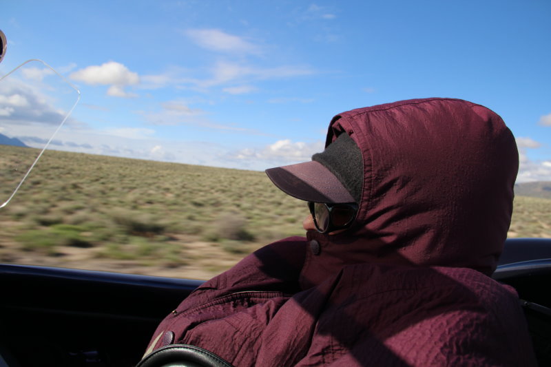
Jeanne in travel mode.
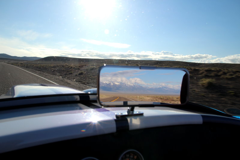
What this double low pressure system was doing.
The drive was going very well from Austin. Nice weather, not getting caught in a bunch of rain...and then it happened. Just as we pulled into Ely for gas, the skies turned very dark. I talked to someone who just came from the Great Basin area and he said it's rainy and clouds in the passes, but the basin was o.k., but he said the clouds were coming up from the south. I found Jeanne and said, "let's go now!!" Maybe we can stay in front of it.
We didn't! We got wet and cold leaving Ely and heading over the pass. I stowed everything of value (including my camera)in the trunk so it wouldn't get wet before we left. I had my phone so it did the photos on the way to Orem/Provo.
Heading into the Great Basin area after getting soaked in the pass.
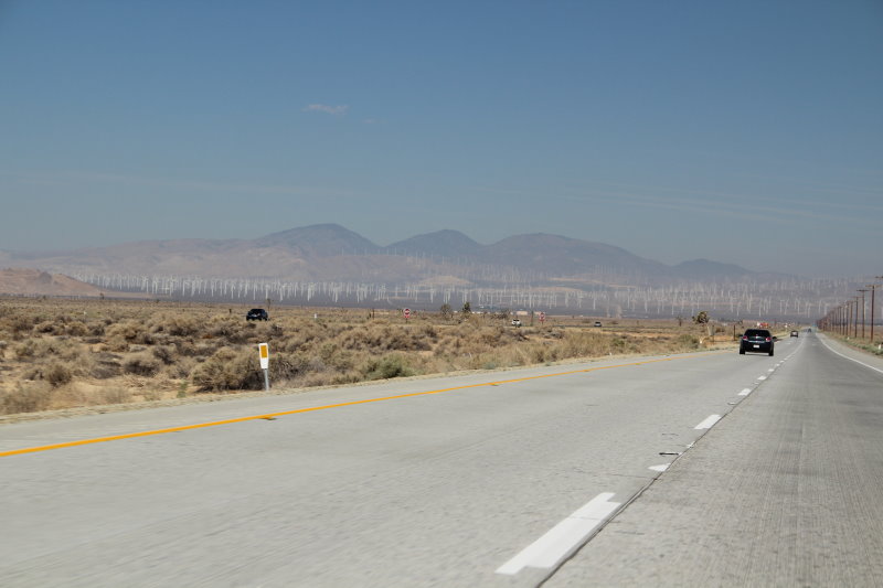
The Great Basin in Nevada is very pretty. I bet it gets hotter than "you know what" in the summer. We passed along another Wind Farm and it was a little windy through the valley. All day I was thinking, "would I be stressed in a closed canopy auto/truck"?

Windfarm in southern Nevada.
After the last excitement, it finally cleared enough for us to continue DRY to Provo. We must have just planned things right or someone was watching out for us. We did get some drops, but nothing like earlier, or what came after we checked in our hotel. The drive from Delta to Provo was nice, but the clouds were following us like a elephant to water. We were able to stay ahead of the approaching weather all the way to Provo. The only mishap was losing my favorite ball cap when a huge semi went by as we passed each other on the "Two Lane Highway" (pun for Pure Prairie League). I even had it tethered to my jacket and it took cap and tether and all! Now I have to wear my stupid hat as Jeanne calls it.

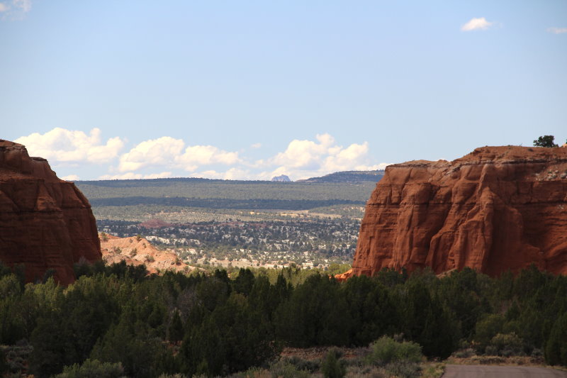
Rock formation just after entering Utah, about 10 miles.
We arrived at our hotel, DRY, in Orem/Provo around 3pm. Sun was out, but you could see what was following us all the way there. I took the car next door to gas up and wash it off at the self car wash. Went down the street to get us a couple of salads and then back and wrapped the car for the night. Around 5pm, it opened up and just pounded the ground for about 30 minutes. As of this writing (6:30pm) it's still lightly raining and solid overcast clouds. Not sure about tomorrow morning so we'll all have to wait and see.
Day 3
Meet at Larry's house in Saratoga Springs around 9am to start the day. Head south on the west side of Utah Lake and on to Fillmore on to Cove Fort then Clear Creek Canyon, stop at Fremont Indian State Park and onto Richfield for the night.
Up at 4am today after a good night sleep. Weather now looks good for the time being and it's dry outside. We'll be having breakfast at the hotel and heading to Larry's around 8:30am to meet up with the Utah Club group. We arrived at Larry's house about 9:15am and met with some of the trip people who were already there. Others arrived shortly and by 10am we had a short meeting and then headed down the road for the days adventure. Oh, it was cool but not raining!!
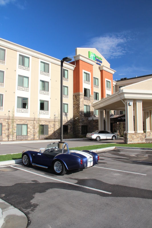
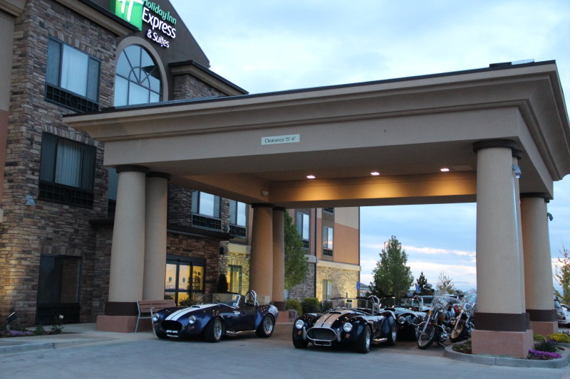
Holiday Inn Express in Orem/Provo
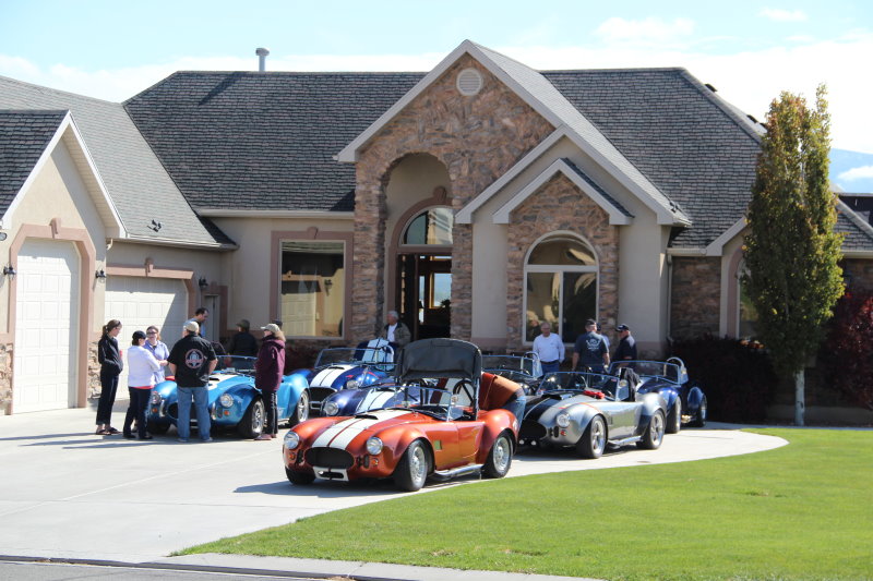
Meeting the Utah Club folks at Larry's house.
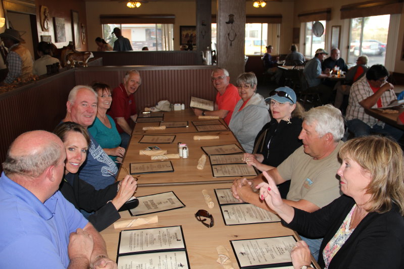
Our first destination was Fillmore to meet up with two other couples coming from Arizona and Southern California. We stopped at a road stop/gas station called the Eagles Landing in Scipio and thought the others were meeting us there. As it turned out, the only people waiting for us were a bus load of Asian tourists enamored with the cars. They started taking pictures, asking questions and even getting to sit in some and get their pictures taken. What a sight! Definitely a high point of the day.
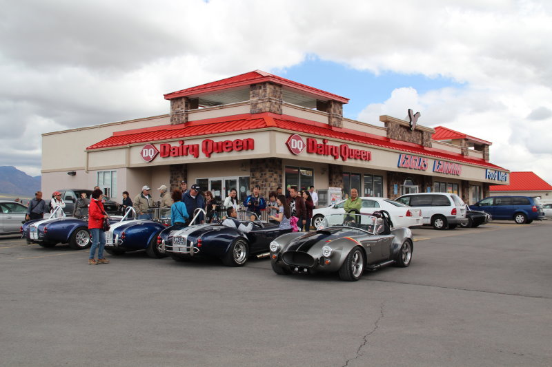
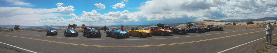
Where ever we go, the Cobra's are magnets!
After a few calls, it was time to hit the road again and meet the others at our lunch stop down the road a bit at Costa Vida in Fillmore, aka Larry's Drive In (yes it was called Larry's Drive In). After lunch it was on the road to Cove Fort. Talk about hard times and way of life, we have it much easier today, although in perspective we'll be thought of as having it hard 100 years from now.
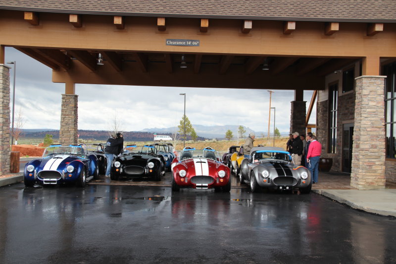
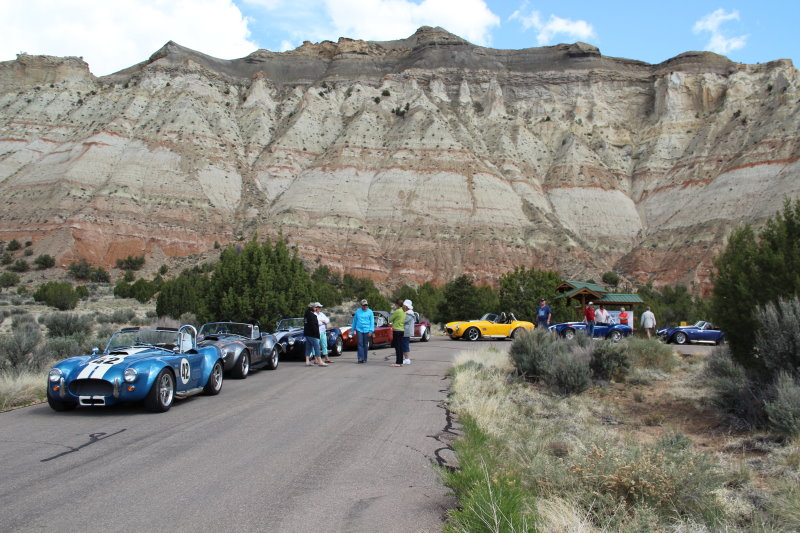
Cobra's parked at Cove Fort Historical Center
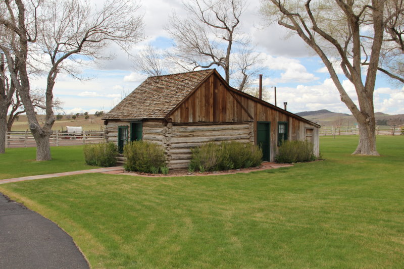
This was the original 13 person home. Yeah, 2 adults and 11 children lived here!

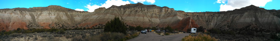
View of Cove Fort
Leaving Cove Fort we headed toward Richfield via Clear Creek Canyon for our "photo op" and during our staging, guess what happened, yep, it started to sprinkle. However, it only sprinkled hard for about 5 minutes and we arrived at the hotel in Richfield dry...again! Everybody got checked in and then we walked over to Frontier Village for dinner. Wow! More eating and we did just that, even had some desert! Back to the hotel for the night and we'll meet up again for more in the morning.
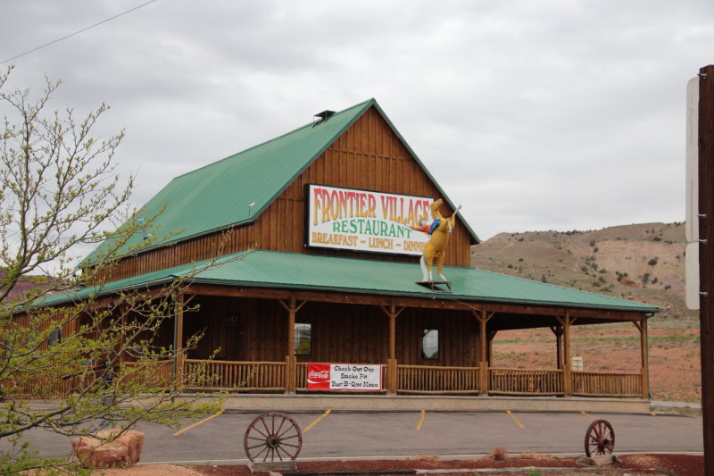
Frontier Village Restaurant BBQ
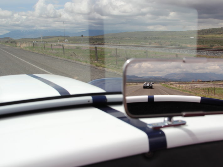
Most of the day I had a great rear view!
Day 4
Head south to our next stop of Bryce Canyon City via Big Rock Candy Mountain (is it made of candy?) and Red Canyon.
Up this morning at 5am after a late night out with everyone for dinner at Frontier Village. Took a few shots of our direction of travel today and it looks like more of the same. Cloudy and cold. Also took some other inspiring pictures, a purple plant/bush/flower (which I'm not sure what it is yet) and Old Glory giving me a good perspective.
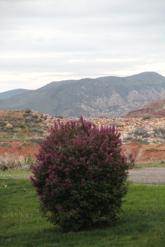
Lilac Plants that are all over Utah
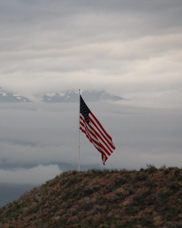
Old Glory flying in the breeze
The hotel let us keep our cars under the canopy last night. They were full and he said he had a lot of respect for the cars.
Holiday Inn Express, Richfield, UT

View of direction of travel at 6:30am
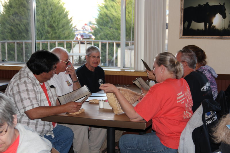
We left the hotel at 9:30am toward Bryce Canyon City. Weather was o.k. not too cold, not too rainy and no sun. We drove back down UT89 to Panguitch via Big Rock Candy Mountain and the Sevier River. Once in Panguitch, we stopped for a break and had lunch at Subway to wait out the front that was coming through Bryce Canyon. That worked out well because we didn't get a lot of rain all the way to Bryce Canyon City.
Driving through Circleville on the way to Bryce Canyon
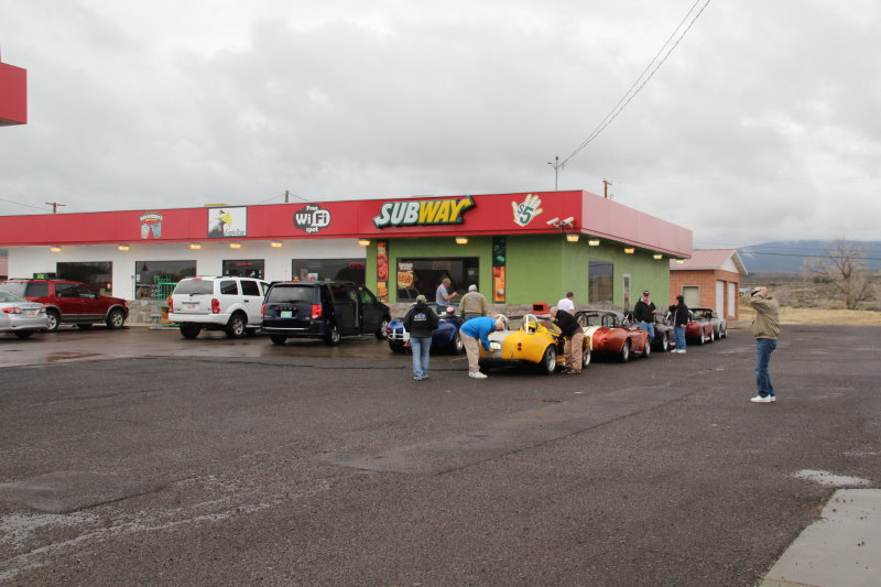
Subway lunch stop in Panguitch
On Hwy. 12 to Red Canyon
We had another photo op by Roy and Les on our way into the park under the rock arch. I'll post his pictures when I get home.
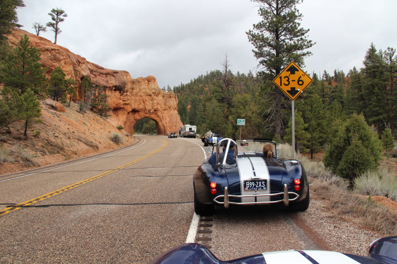
Waiting our turn for Roy to take shots coming through the arch

Gathering up after the arch run
Bryce Canyon City, Best Western Plus
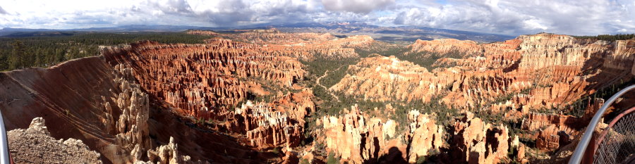
Once we arrived at the Best Western Plus hotel in Bryce Canyon City, we were lucky they had all the rooms ready. Most of us decided to brave the weather once more and drive into Bryce Canyon to see the sights. We drove to Sunset Point and then on to Inspiration Point for leg stretching and some really good pictures. This park is one beautiful piece of natures work. Once there, the skies opened up and we got some nice sun for about two hours while we viewed the limestone formations and surrounding area.
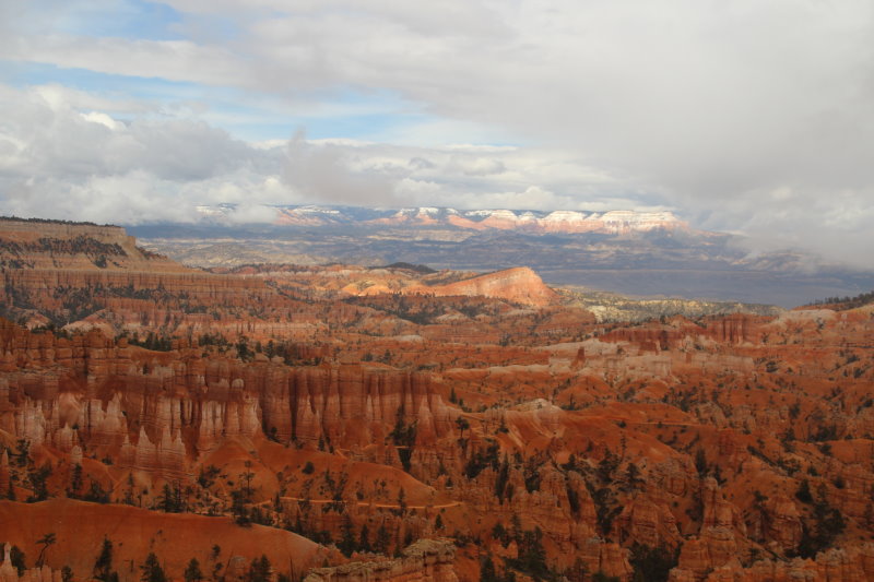
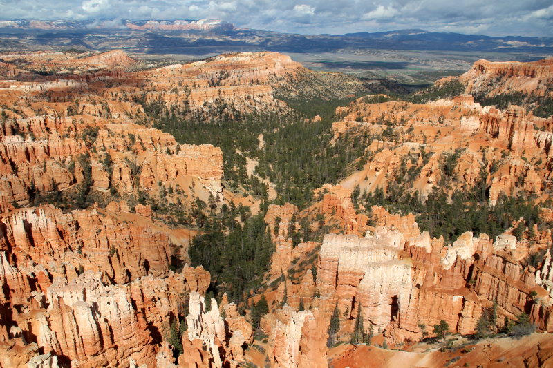
View from Sunset Point, Bryce Canyon
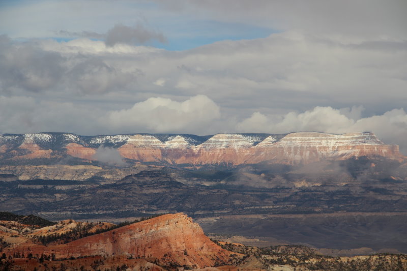
Snow capped spires across the canyon
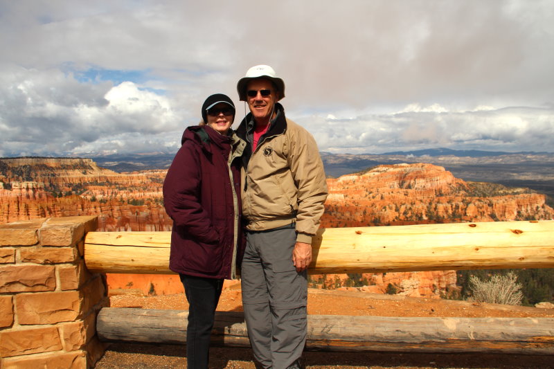
Jeanne and me at Sunset Point
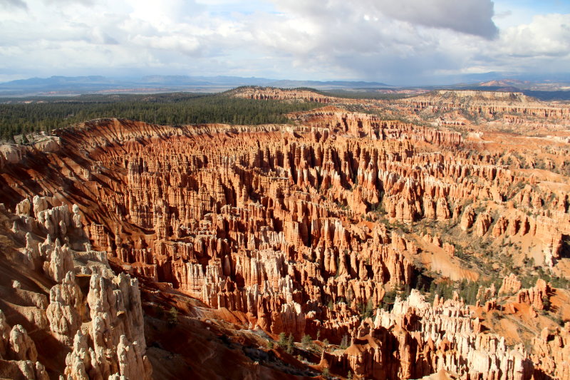
View of Bryce Canyon and Tropic Valley
Area called Silent City
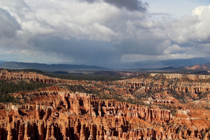
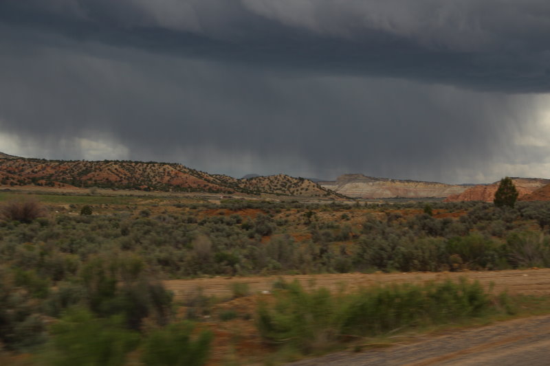
View of canyon with rain cell moving in

Snakes in the parking lot

Les get's busted for license plate expiration...huh? No, he really got caught speeding
and the Park Ranger only caught him because he stopped!
This picture was taken from Inspiration Point (D. Meldrum)
After returning to the hotel we all regrouped at 6:20pm for a short drive to Fosters for dinner. Also greeted with a small hail storm passing through. We've had just about everything on this trip. I have to admit that the Utah Cobra Club are real troopers. Cold, wind, rain, hail or snow, they GO!
Day 5
Off to Torrey via Escalante and Boulder along SR12.
We woke up to clear blue skies and cool weather. What a nice site to see after 5 days of overcast and wet days! There was a light coat of frozen water (light snow) on the cars, but the ground was dry. We gathered at 10am for our morning gas stop and then proceeded with our drive to Torrey along scenic UT12.
Morning shot from our bedroom
Fueling up at the "Sign of the Star"
We immediately started our decent toward Kodachrome Basin State Park through Tropic and Cannonville, which we saw from the rim of Bryce Canyon the day before, and the sun painted a nice glow on the surrounding area. Never having been to Southern Utah, the views were incredible. I'll be posting some video's of the drive once I return home.

Drive toward Kodachrome Basin
Looking through the natural break entering the basin, from inside
Cobra's in Kodachrome...get it?
Panoramic of Kodachrome Basin
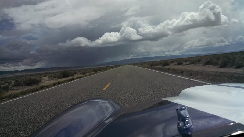
After leaving Kodachrome Basin, we started a climb toward Escalante. More clouds started to form and we did get a little rain just before arriving in Escalante, where we decided to stop and get a bite at the Subway and wait for better weather. To our surprise, the cloud burst only lasted a few minutes and once on our way, we had ample sun and parting clouds the rest of the day. I can't say enough how pretty the area is, especially with all the cloud formations that gather. It is really a breathtaking experience to what nature can do.
Cloud burst when leaving the basin
Pullout on Hwy.12 overlooking the Grand Staircase
This is on a ridge with drop offs on both sides of the road
We continued our climb out of Escalante and had great views of the Grand Staircase National Monument. We stopped at an overlook for a group photo. Although we didn't do any exploring or hiking, for those wishing to see the wonders of this place would be greatly rewarded.
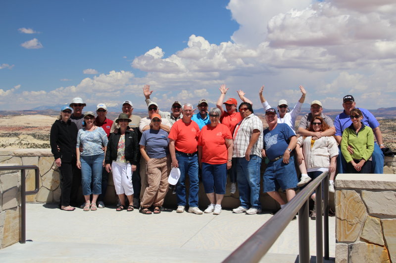
Our group at the overlook
Back row, left-right: Glenn, Larry, Pete, John, Bud, Barb, Lynda, Arelene, Allen, Doug
Front row, left-right: Jeanne, Shirley, Janet, Victoria, Richard, Jean, Les, Roy, Krista, Tammy
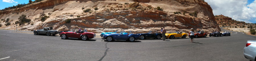
Cobra's at the overlook turnout
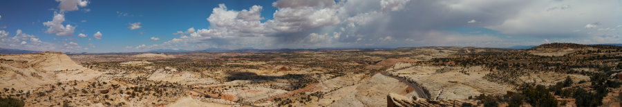
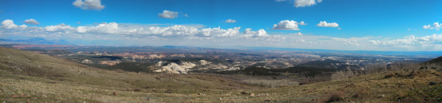
Grand Staircase Panorama
Another stop was the Anasazi State Park Museum in Bolder. It shows the history of civilization in the area of the Ancestral Puebloan Indians that inhabited the area.
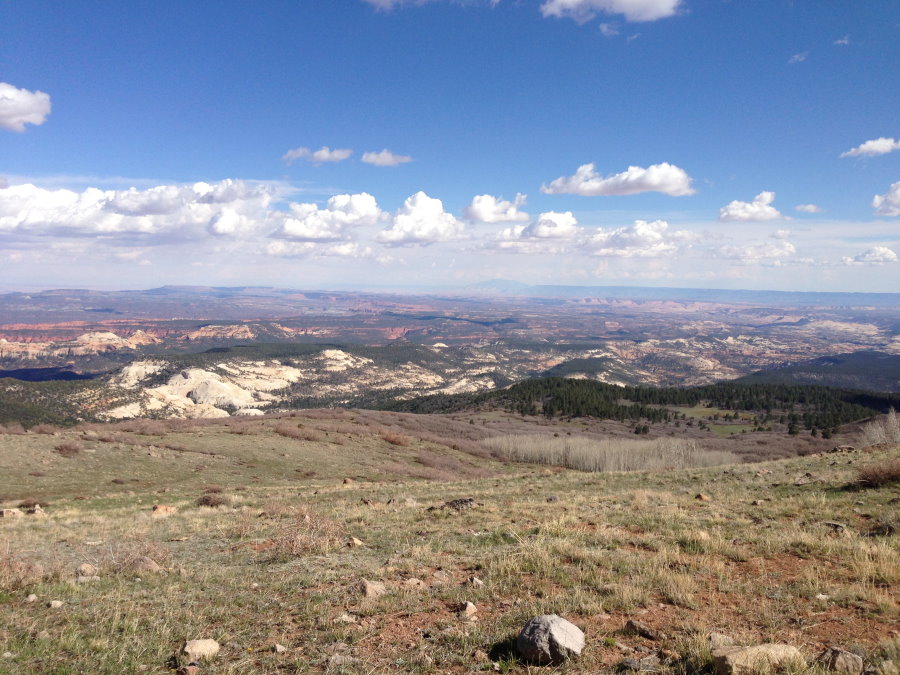
Once again on the road we started our climb to the 9600ft. pass before descending into Torrey. We stopped once again just before the top and the view was unbelievable to say the least. It was breathtaking! Views of the Waterpocket Fold Cliffs (Henry Mountains), Capitol Reef National Park, Glen Canyon National Recreation Area, Grand Staircase National Monument and Navajo Mountain were just some of the sights you could see. With the weather clearing things out, you could see for miles.
View from the top looking Southeast
Another panorama by Doug Meldrum
What's a mountain run without some "spirited" driving. The twisty sweeping curves were a delight to spend some time letting the car do it's thing. All within control of being crazy, it was just fun to push the car a little and have some fun. The Quaking Aspens still haven't leaved yet so the forest looked a little ominous, but I can imagine what it looks like in the summer when everything is green. Once passing the summit of 9600 ft. we started our decent to Torrey through Grover. Wild deer were along side the road and you could see their heavy coats of fur still on them. I don't doubt it either, it was still cold.
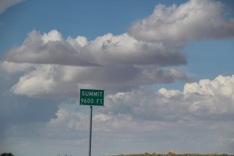
9600 foot summit
Once checked in our hotel, we drove up the hill for dinner and more talk about reliving the day and trip as a whole. I really want to thank Roy and Arlene for putting a great run together and thankful we were able to join them and their friends.
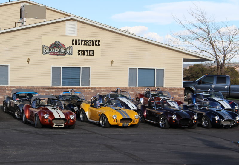
Our Broken Spur dinner place up the hill from the hotel
Our dining table.
Left side: Doug, Tammy, Roy, Arlene, Shirley (hiding), ??? (Larry) :)
Right side: Janet, Pete, Jeanne, Glenn(taking picture), Jean, Richard
Other table at dinner.
Left side: Les, John, Victoria
Right side: Lynda, Bud, Barb
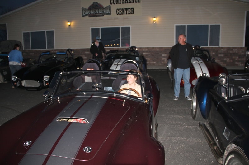
Our waitress with a "special ride" after dinner
Up this morning to another beautiful sunny day. Still on the cool side, but no rain! I guess the sun can really come out two days in a row in Utah. I know the clouds will form later and we'll probably get a little wet, but it won't be near as bad as it was earlier in the week. We gathered at 9:30 to discuss the route home and we all decided to forgo the long way and head back to Richfield to say our good-byes. We drove back on UT24 through the towns of Bicknell, Lyman and Loa to UT119 to Richfield. As we entered Loa there was a Sheriff on the side of the street parked. I guess he was waiting for speeders. I did notice that all the small towns have reduced speeds as they are all directly on the state highways, which run right down their main street. One of the other things I forgot was the fact that most of the driving was between 4,000 and 9,000 feet during the entire Utah trip! It can easily skip your mind when driving and thinking that Southern Utah is flat desert.
Days Inn Hotel in Torrey, UT

Richard, Arlene, Roy and Lynda having fun "dealing"!
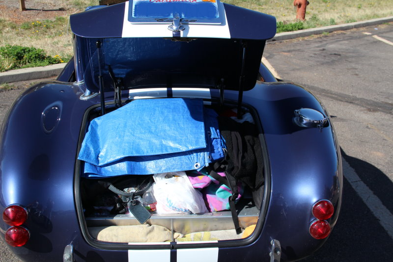
The Weendoggy trunk packed and ready to go...again!

Driving Hwy 24
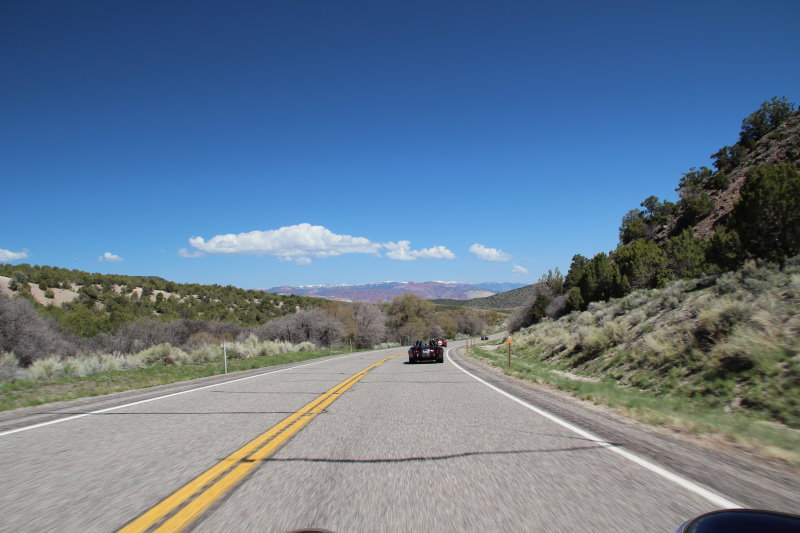
More of Hwy 24...nice "twisty's"
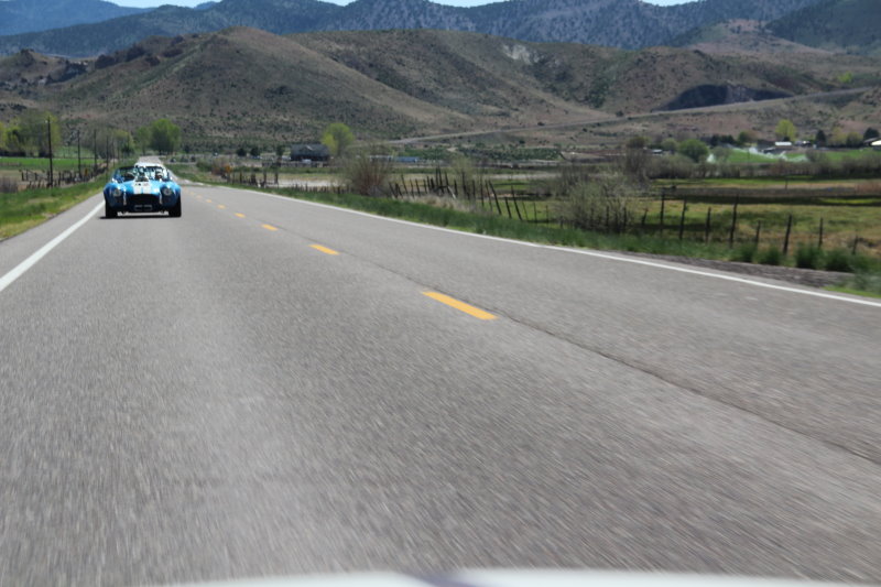
Allen and Krista behind us
Once back in Richfield, we all got out to say good-bye. Jeanne and I had a great time despite the weather and the Utah Club are really neat people to go on trips with. Saying good-bye is always hard, but the reward is being able to meet again for antoher run. Again, Roy and Arlene did a fantastic job putting this trip together and I'm sure we'll be back again to join them on another outing. Maybe they can come California way?????

Saying goodbye to the Utah Club and folks from Arizona, California (yes there were more) and Oregon
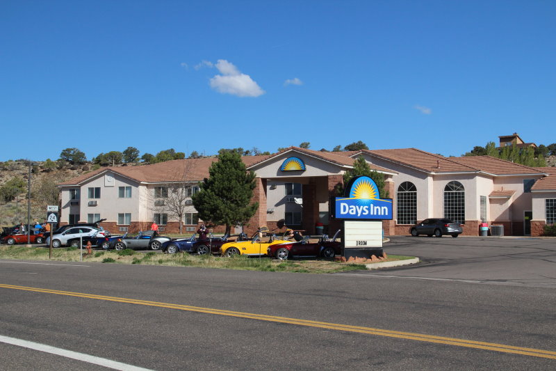
Jeanne and I started our trip down the freeway to Washington, UT for the night. We had made reservations the day before after talking to Roy about the last days drive. We stopped in Cedar City for fuel and decided to have an early dinner so we wouldn't have to go back out after arriving at the hotel. Just after leaving Cedar City we got sprinkled on again. However, we were doing the speed limit of 75mph and it was 70 degrees outside. I drove that distance in a tee-shirt! We arrived around 3:30pm and decided that getting a good rest was best. We're planning on leaving at 4:30am Sunday morning or earlier if we're ready.
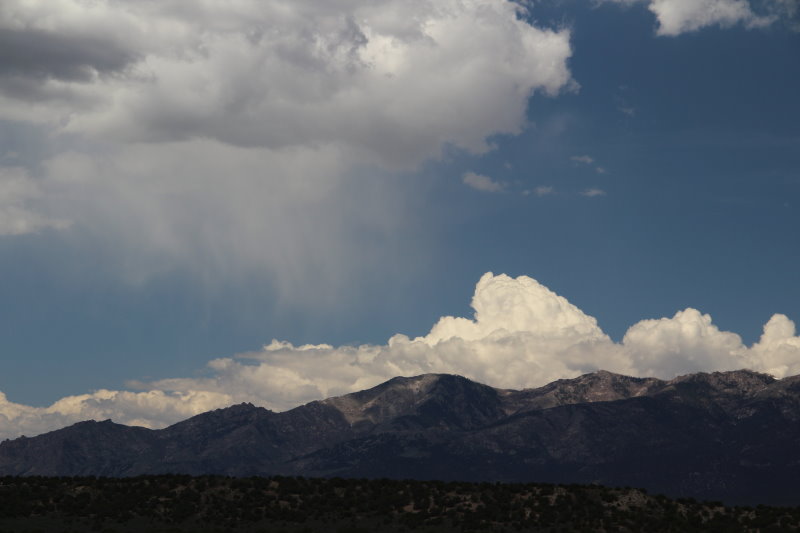
Clouds along I15 south to Washington, UT
Day 7
Last day on the road heading home. We'll be leaving early from Holiday Inn Express in Washington, UT (just north of St. George, UT). Our plan is to leave by 4:30am and get home between 3-4pm.
Well knowing us, we got up early and were on the road at 3:50am MT. Yep, not a creature was stirring, not even a lizard. I wanted to get going early to beat the heat across the desert. I'm glad we did because it did get warm. We had eaten a late lunch/early dinner in Cedar City at Sizzler's and then gassed up and drove on to Washington, UT to stay at the Holiday Inn Express there. Roy had told me there wasn't anything to do there so eating early and getting a good rest was just fine with us.
We drove through to Las Vegas but decided to keep going to Primm, NV and stop to gas up and have some breakfast. We stopped at Whiskey Pete's and after breakfast, Jeanne wanted to play her quarters. She found a machine and within 15 minutes, hit a jackpot for $800.00!!!

Jeanne's Jackpot Club
Driving across I15 desert in CA.
The Mojave Windfarm
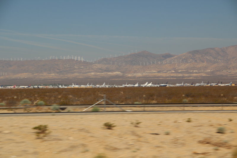
Mojave mothball fleet of old planes
After that, the next stops were 58/395, Famoso and then King City before reaching home at 3:00pm. Needless to say, we were tired. I think the entire trip was over 2,000 miles. I'd definitely go back again and maybe do it in early fall some year.
Driving across the desert is always interesting and weather can really change. We left Washington, Ut at 65 degrees and the temperature changed up and down all the way to Las Vegas. Cold spots were there, and then gone. Jackets and the heater were a must in the open cockpit Cobra. I did have to put my gloves on a few times as well. Overall the trip was another adventure and I always say we won't do that again, but I know deep down, I'll continue to take the gamble when taking the Cobra and always be prepared (except for snow) for the unexpected. I know is sounds crazy and probably is, but doing things in life is just that, "crazy"! I'm going to continue to reward my life with things I can do unitl I can't.
The Cobra ran great the entire trip with a little stumble at some elevations, but nothing serious like the last trip across country. Larry had his son's car and the only issue we had there was to put a throttle return spring on because the pedal was sticking. That problem was fixed the first day. I think Richard's car needed some water after Bryce Canyon City because he found his radiator cap was loose. No other problems and ALL of the Cobra's were Factory Five Racing!
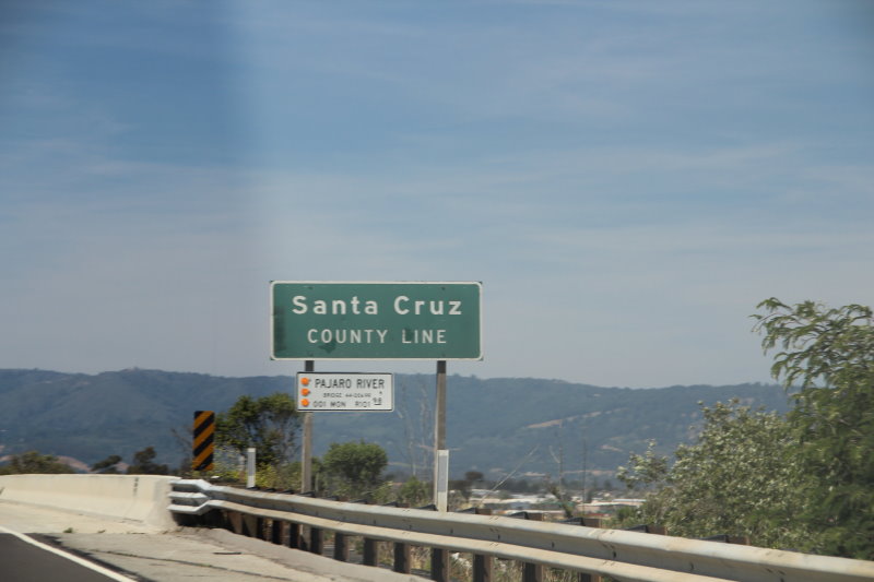
Arriving back in Santa Cruz County, 15 minutes from home.
Thanks again to the Utah Cobra Club for putting on a good run and I'm sure we'll be back again to join them.
Odometer Site Hits